
Why Vikings
Why Vikings?
Although our branding may seem to be Viking based, it is not. We have used what we know as “The Norse Pantheon”, that is the Gods and Goddesses of the Norse pre-Christian beliefs. Viking itself is a term that was created around 700CE to describe a job, in particular ‘raiding’ . A Vikingr was a person doing the raiding, this would then be a raider. In modern terms a Pirate. A Vikingr would raid for wealth and return to their family. Those who settled over here were no longer Vikingr. Vikings are not a race of people, they were the Danes (hence the Danelaw), Norwegians and Swedish. The Norwegians took such lands as the Faroe, Shetland and Orkneys.
Why did we choose to use the Norse Pantheon of Gods & Goddesses?
Well it is quite simple in that, as a Druid, the Meadmeister is in touch with the land especially in the area of his birth and 56.25 years of captivity in Bolton. We tried using the Celtic Pantheon. But one particular mead proved antagonistic, it was misbehaving, and after several ‘episodes’ Loki sprang to mind. So it is no surprise that looking at place names we can find the history of a area.
In the immediate surroundings of Horwich (we’ll come back here) we have lots of Anglo-Saxon, Danish and other Norse influences reaching out to the Sefton coast from Liverpool all the way up to Southport, Banks and Tarleton on the Ribble estuary. We are not historians, we make Mead and what we present is information gathered though various council, village, parish and historical websites, if you have any information not here please use the contact form and we’ll add it or correct what we have here. So it stands to reason that the Norse deities became the branding we use. That and it was Loki’s fault
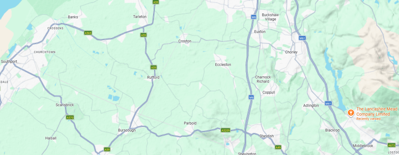
Map courtesy of Google Maps
Origins
So when the Meadmeister made his very first Mead it was at a friend’s parents holiday cottage, on the banks of the River Yarrow. In an area known as Three Ways Woods, the cottage was called Dry Bones Cottage, which is derived from the Germanic Drei Bahn or 3 Ways. The 400 year old cottage was burned to the ground in 2010. A criminal hiding from Police used it and the result was from ‘hiding their tracks’.
Nearby on the banks of the River Yarrow is what looks likes like an upturned boat which has become a hillock, about 15m long and 3m wide. The area the cottage is in is Duxbury, now an area of Chorley. Duxbury itself dates back to a Saxon called Deowuc pronounced Duke. More on the man and area can be found here. This is the site that really got the Meadmeister researching this area explaining where the 3 Ways comes from. Now any American history buff should recognise the name Myles Standish as he was aboard the Mayflower. He was appointed Military Advisor for the Plymouth Colony in Massachusetts. There is even a Duxbury in Massachusetts, where a monument to him now stands. All we get is a road!
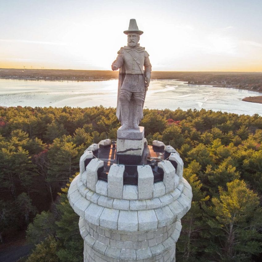
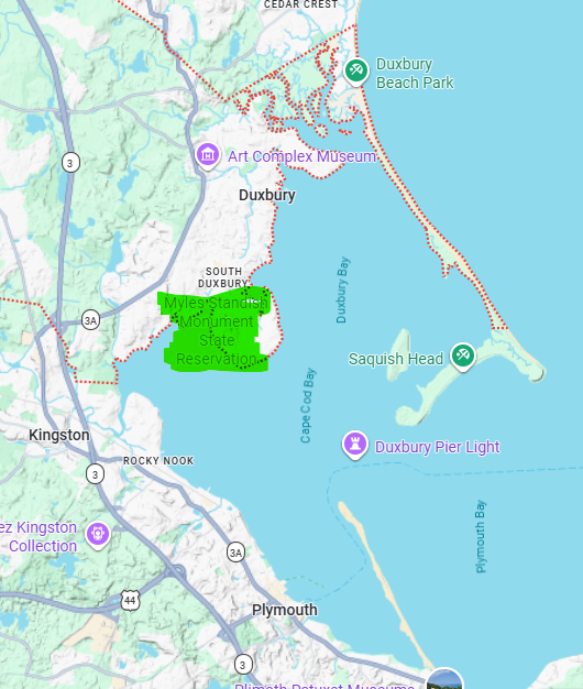
courtesy Google Maps
So we have Saxons sail up the Yarrow from overseas to build a new life here and then later their possible descendants sail away from there to create a similar new life overseas. And it is what saw Deowuc, Ulf and more besides sail (row) up here who aren’t remembered, like poor King Horik, who we will meet momentarilly!
The Wider Geography
The name Chorley originates from two Anglo-Saxon words: ċeorl (meaning a freeman, yeoman, or peasant) and lēah (meaning a woodland clearing or pasture). Together, the etymology translates to “the peasants’ clearing,” describing the town’s humble beginnings as a small farming settlement cleared from ancient woodland. This “ċeorl” status may have been given by Deowuc himself! Chorley is also one of the only places outside Scotland where the suffix “Burgh” is used. South Burgh Lane and Burgh Way are connected to Myles Standish Way. In England it has become either Borough or Bury.
Back to Horwich. It seems that there are various etymologies. Both are from the Old English. Firstly the words har (meaning grey) and wice (meaning wych-elm), and secondly, hræfn (raven) and wīc (woodland or settlement). These could also be wrong because in Danish, Eric translates as Horik. This plays into the Danish names in this area and the end of the navigable waterways from the Ribble. Any of these 3 variations puts us back into the Medieval period.
Horwich to Chorley
Less than half a mile from the Meadery you arrive in Anderton, from the Anglo-Saxon Eandred, and encompassing the Rivington and Anglezark reservoirs, it is a large but sparsely populated ‘village’ with most of the properties within a 100m stetch at both ends of a 2 mile long road.
Rivington derives from the Old English words hrēof (rugged or rough) and tūn (farmstead), meaning “a settlement in a rough place” and dates back to around 620CE. The Tithe Barns remain and are open to the public, one is a cafe and gift shop, the other used for Weddings. On a Sunday and Bank Holidays you will find motorcycles gather at the ‘Top Barn’
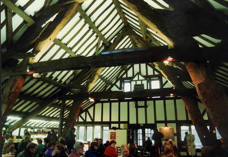
The interior of Rivington Lower Barn
Anglezarke was a village that was flooded to make way for reservoirs, it’s name is derived from the Old Norse name Anlaf and erg, a ‘hill pasture or shieling’. The elements together mean ‘Anlaf’s hill pasture’. In 1202 it was recorded as ‘Andelevesarewe’. By 1225, this had become ‘Anlavesargh’. In a deed of 1270, three variations were used: ‘Arlawesarwe’, ‘Anlasargh’ and ‘Anlezark’. By 1559, ‘Anlazarghe’ was more common. There are more “sargh’s” around Preston namely Goosenargh and Grimsargh.
The next is Adlington is derived from Old English. It means “the farmstead or estate of Eadwulf‘s people”, Heath Charnock which is of Anglo-Saxon and Celtic derivation literally meaning ”a pile of rocks on the Heath”. We now enter Duxbury
Duxbury to Ulnes Walton
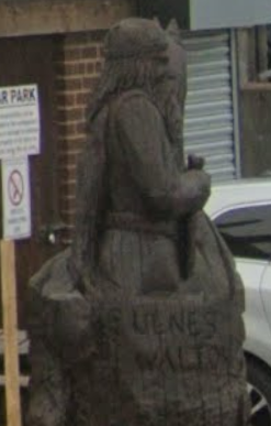
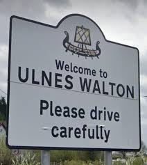
Further out from the meadery we have Euxton which goes back to an inhabitant called Efe. Keep on going west and you arrive at Ulnes Walton. Ulnes Walton derives it’s name from a Dane who came up the Yarrow or as legend has it the original UIf was a Danish pirate (read Viking) who sailed up the river Douglas, into the river Lostock and settled at Littlewood. Ulf’s manor house was on the site of Littlewood Hall, about two miles from Ulnes Walton school. in his boat and settled at this point, an image of Ulf in his boat adorns the entrance to the local timber merchant -John Henry Mayors, and the village road sign is emblazoned with a ‘Viking’ ship
Ulnes Walton to Crossens
COMING SOON!!!
The Journey Continues along the Sefton coast
And the list goes on. As we move along the Sefton coast in later pages, we find townships ending in ‘by’ Crosby & Formby. In Liverpool you have Toxteth and Knotty Ash, where there was a Thing, a meeting hall for Viking chiefs. We even bought a house in one of the oldest Viking settlements of Crossens, approximately 500m from where a 6th century tree trunk canoe was found. Isn’t it fantastic what you find out later?
The Crossens Canoe
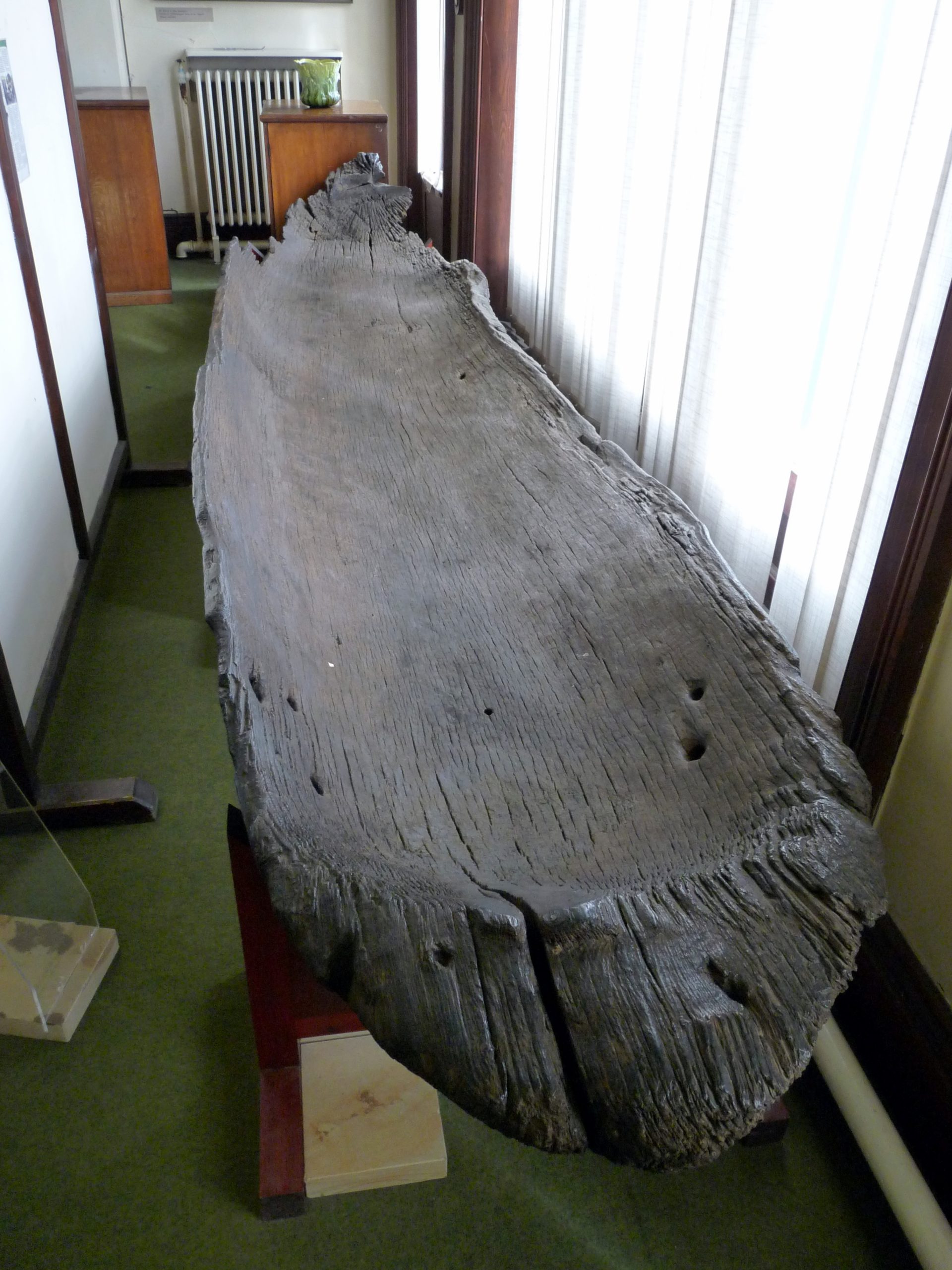
Called the Crossens canoe, it had been repaired using metal plates and radiocarbon dated to AD 535. It was found in 1899 and even contained a musket, proving how it had been repurposed.
The Crossens Canoe
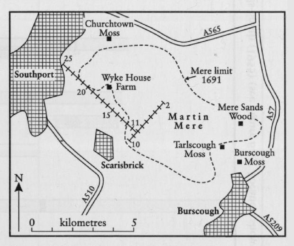
So the location would have been the original edge of Martin Mere. Now a Wetland Nature Reserve, it was drained to provide agricultural lands for Lord Hesketh’s Tenant Farmers. Before it was drained for in the late 1600s, Martin Mere was the largest freshwater lake in England. Covering over 19 sq Km (roughly 5 – 6 sq miles or 690 hectares – for reference a 24 page pdf can be read here
Crossens is on the tip of the peninsular where the Ribble Estuary meets the Irish Sea/Liverpool Bay. Historically, and to this day, it is known as North Meols. Meols is derived from the Old Norse Melr, meaning Sandhills. The Crossens part is derived from having a Cross on the hill, said to guide boats across the estuary.